
Properties
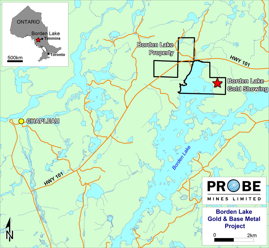
Project SummaryThe Borden Lake property represents a new gold discovery associated with Timiskaming-age sediments in an underexplored part of the Kapuskasing Structural Zone. Timiskaming sediments often show a spatial association with large-scale Archean lode gold deposits such as those found in the Timmins, Kirkland Lake, Hemlo and Red Lake gold camps and thus represent an important geological indicator for the gold potential of an area. 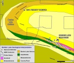 Borden Lake Geology (this map is based on an initial geological interpretation of existing data) Click on image to view enlarged 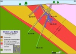 Borden Lake Cross Section (this map is based on an initial geological interpretation of existing data) Click on image to view enlarged The gold discovery was made within one kilometre of Highway 101, which links the towns of Chapleau and Timmins, and is approximately 15 kilometres from well-developed infrastructure in the Town of Chapleau itself. The Chapleau area has seen historic gold exploration and development activity, however, no significant work has been done in the Borden Lake area and the zone represents a significant new gold discovery in a previously unexplored area. The Borden Lake project has been the main focus of Probe's exploration programs since significant gold mineralization was confirmed in November 2010. 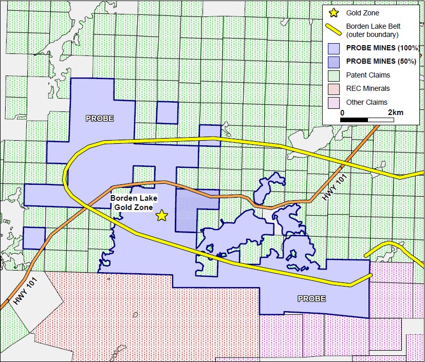 Borden Lake Location Map click on image to view enlarged An initial NI 43-101 compliant Resource Estimate, based on 78 drill holes, was released on the Borden Lake gold zone in August, 2011. An Indicated Resource of 0.3 million ounces Gold (Au) (0.82 g/t Au) and 0.32 million ounces Silver ("Ag") (0.9g/t Ag) plus an Inferred Resource of 3.8 million ounces Gold (0.69 g/t Au) and 5 million ounces Silver (0.9 g/t) were calculated. An extensive drilling program continues; to date 113 holes have been drilled. It is expected that the pending assay results from these holes should facilitate the upgrading of much of the resource from the inferred category. In addition to infill drilling within the area of the resource estimate, drilling is also focused on expanding the limits of the mineralization and further defining the satellite gold zones, recognized during the resource estimation, as well as exploration targets further along trend to the northwest. INDICATED MINERAL RESOURCE ESTIMATE
INFERRED MINERAL RESOURCE ESTIMATE
1. Tonnes and ounces have been rounded to the nearest thousand 2. Figures/numbers for resource tonnes and ounces may not tally due to rounding | |||||||||||||||||||||||||||||||||||||||||||||||||||||||||||||||||||||||||||||||||||||||||||||||||||||||||||||||||||||||||||||
- Overview
- McFauld's Lake
- West Timmins
- Cree Lake
- Borden Lake
- Technical Report on the Initial Mineral Resource Estimate for the Borden Lake Gold Deposit
- Drill Results September 2011
- Images of 2D Drill Sections August 2011
- Drill Results August 2011
- Drill Results July 2011
- Drill Results June 2011
- Drill Results March 2011
- Drill Results December 2010
- Drill Results June 2010
- Project Summary
- Project Map
- Goldex Royalty
- Technical Reports
- Migliori Siti Casino Online
- Casinos Not On Gamstop
- UK Gambling Sites Not On Gamstop
- Non Gamstop Sites
- сasino En Ligne Retrait Immédiat
- Casinos Not On Gamstop
